

Sugar Loaf [Y Fal]
Good walks are even better shared.
SO2718 : Triangulation Station on top of Sugar Loaf
Ian Paterson Photo source
Overview
Sugar Loaf [Y Fal] is a 596m hill in the Black Mountains above Abergavenny, with a summit trig point and wide views. Grassy, heather and bracken slopes lead to a steeper rocky summit. Choose a shorter approach from Mynydd Llanwenarth or a longer walk from town, and plan for changeable hill weather.
Sugar Loaf [Y Fal]
Sugar Loaf rises to 596m above Abergavenny in the Black Mountains, within Bannau Brycheiniog (Brecon Beacons) National Park. Its prominence is 411m, and the hill is a Marilyn, Dodd and Dewey. The summit is at SO272187.
Choosing an approach
- Mynydd Llanwenarth summit circuit: start and finish at the National Trust car park, SO268167. The National Park’s 5km circuit follows a grassy approach and western embankment to the summit, then descends south to rejoin the outward path at SO266179 and return to the car park. Allow 2–3 hours; the publisher grades it strenuous.
- Abergavenny town circuit: the Angel Hotel publishes an approximately 13.5km walk starting and finishing at the hotel, 15 Cross Street. It climbs through St Mary’s Vale via Pen-yr-Heol, reaches the summit, and descends towards Rholben before returning along the woodland edge and Chapel Road. Allow 5–6 hours for this strenuous outing. A different town starting point changes the distance.
Follow a current map and a complete itinerary. Offa’s Dyke Path follows the Hatterrall Ridge in this part of the Black Mountains; it does not run over Sugar Loaf.
Ground and summit
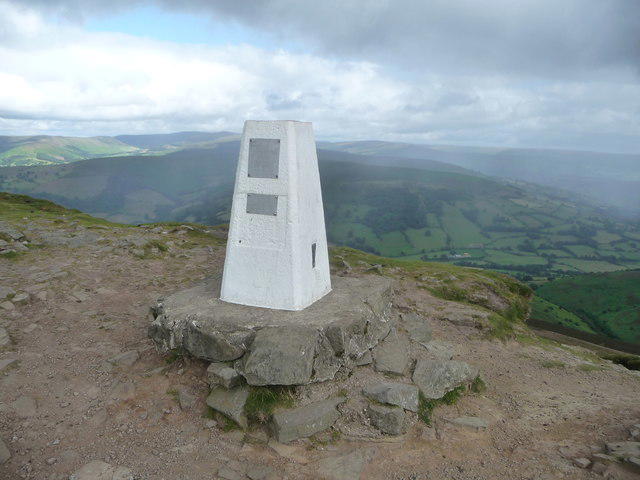
The slopes include grass, heather and bracken, with several intersecting paths. Rock and loose material make the upper climb and descent rougher. A trig pillar marks the summit area; the hill database notes nearby rocks slightly higher than the worn ground at its base.
The open top gives wide views over the Black Mountains and Usk Valley, with more distant horizons dependent on visibility. There is no season that guarantees clear views.
Geology and local history
The hill is formed from Devonian Old Red Sandstone rocks. Its lower slopes include the Senni Beds and Brownstones; resistant quartzitic sandstone of the Wern Watkin Formation caps the summit. These are sedimentary rocks, associated with ancient river systems.
The English name describes the hill’s sugarloaf-like outline. Below it, Parc Lodge preserves the landscape of a medieval deer park, including a surviving boundary bank. St Mary’s Vale and the Cibi Valley lie between the hill’s wooded southern spurs.
Getting there
Llanwenarth’s small car park is reached by narrow lanes. The road passes the vineyard and continues uphill to the walking start. The National Trust currently recommends Fairfield car park in Abergavenny, NP7 5SG, as an alternative, with a longer walk that needs planning.
Abergavenny has a railway station and bus services, but the upper trailhead is not directly served by public transport. Check current connections and allow for the onward walk or transfer. Use town facilities before setting out.
Safety
Steep, uneven ground and loose stones need care, especially when wet. Mist can make route-finding difficult among intersecting paths. Check the mountain forecast, carry suitable clothing and navigation equipment, and keep dogs on short leads around livestock.
Further information
Explore routes near Sugar Loaf [Y Fal]
Walks starting near this hill. Open a route to check its map, distance and full itinerary.
A Very Merry Winter Walk ending with Cake & a Hot Drink!
View route
Goytre Wharf to Pentre Bridge: Mon and Brec Canal Walk
View route
Clytha Estate: River Usk, Chapel Ruins and Castle Woods
View route
Brecon Basin to Brynich Aqueduct: Canal Towpath Walk
View route
Route planning notes
These notes describe possible approaches. Check a route's map and access information when planning your walk.
Sugar Loaf circuit from Mynydd Llanwenarth
Starts and finishes at the National Trust car park on Mynydd Llanwenarth, SO268167. Follow the grassy approach and western embankment to the summit, then descend south and rejoin the outward path at SO266179 for the return to the car park. The National Park grades this 5 km circuit strenuous; allow 2–3 hours. The upper paths are steep and loose.
Sugar Loaf circuit from the Angel Hotel, Abergavenny
Starts and finishes at the Angel Hotel, 15 Cross Street, Abergavenny. Follow Chapel Road and St Mary’s Vale via Pen-yr-Heol to the summit; descend south-south-east towards Rholben, then by the edge of St Mary’s Vale and Chapel Road back to the hotel. The hotel’s published circuit is approximately 13.5 km; allow 5–6 hours. Use the full itinerary and a current map.
Make a day of it, together
Find someone to share the walk with, or organise a day out along a route you like.
Photo Gallery
View all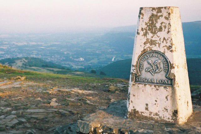 Photo could not load
SO2718 : Triangulation Station on top of Sugar Loaf
Ian Paterson
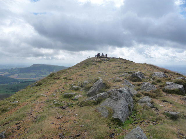 Photo could not load
SO2718 : View along the summit ridge of the Sugar Loaf in summer
Jeremy Bolwell
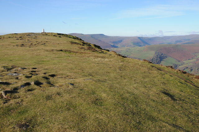 Photo could not load
SO2718 : On the Summit of Sugar Loaf
Philip Halling
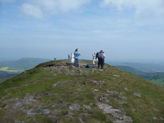 Photo could not load
SO2718 : Sugar Loaf summit
Jeremy Bolwell
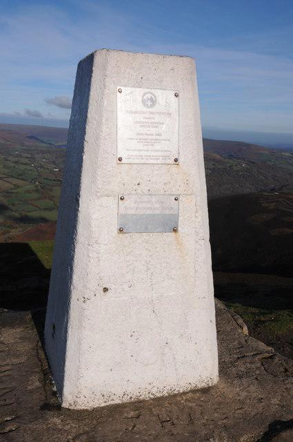 Photo could not load
SO2718 : Trig point, Sugar Loaf
Philip Halling
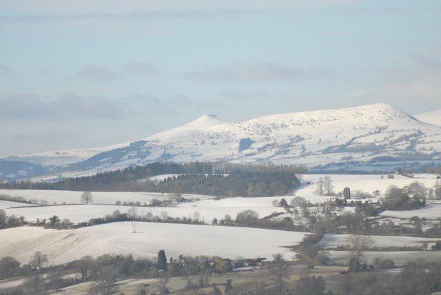 Photo could not load
SO2718 : Winter View of the Sugar Loaf and Ysgyryd Fawr
Peter Randall-Cook
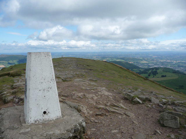 Photo could not load
SO2718 : Sugar Loaf summit in August
Jeremy Bolwell
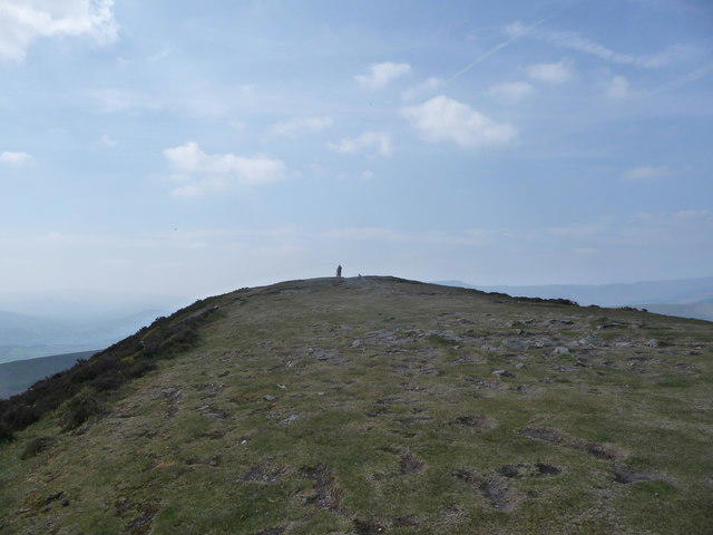 Photo could not load
SO2718 : On the Sugar Loaf summit cone
Jeremy Bolwell
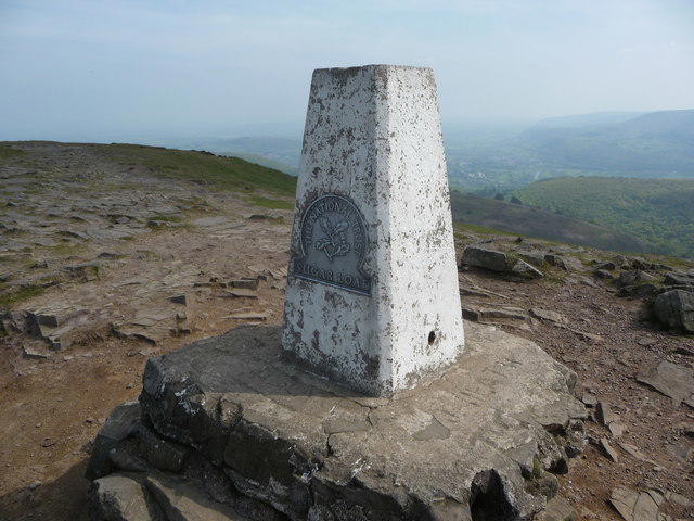 Photo could not load
SO2718 : The summit trig point on the Sugar Loaf
Jeremy Bolwell
SO2718 : The summit trig on the Sugar Loaf with the Black Mountains behind
Jeremy Bolwell
Hill facts and local notes
Classifications
Elevation
596m
1,955 ft
Prominence
411m
Coordinates
51.8627, -3.0579
SO272187
OS Map
161
Explorer: OL13S
At the Summit
A trig pillar marks the summit area. DoBIH records a semicircle of rocks slightly higher than the worn ground at the pillar’s base. Views depend on the weather.
Terrain & Geology
Sugar Loaf is formed from Devonian rocks of the Old Red Sandstone succession. The Senni Beds and Brownstones form the lower slopes, while resistant quartzitic sandstone of the Wern Watkin Formation (Quartz Conglomerate Group) caps the summit. These sedimentary rocks record ancient river environments; the hill is not volcanic.
Views & Scenery
Wide views across the Black Mountains and the Usk Valley, with the central Brecon Beacons and parts of South Wales and south-west England visible in clear conditions.
History & Heritage
Name Origin
The English name describes the hill’s resemblance to a conical sugarloaf. The hill catalogue also records the Welsh name Y Fal.
Historical Significance
Parc Lodge below Sugar Loaf was a medieval deer park, probably associated with Abergavenny priory. A surviving boundary bank marks part of its former enclosure. The open hill is common land with grazing rights held by local farmers.
Getting There & Facilities
Parking
National Trust car park on Mynydd Llanwenarth, grid reference SO268167, for the shorter summit circuit. Spaces are limited and the approach lanes are narrow. The road passes Sugar Loaf Vineyard and continues uphill. The National Trust recommends Fairfield car park in Abergavenny (NP7 5SG) as an alternative; walks from town are longer and need planning. Check current signs and parking advice before travelling.
Public Transport
Abergavenny has a railway station and bus services. The Mynydd Llanwenarth trailhead is not directly served by public transport. Plan a longer approach from town or an onward transfer, and check current services before travelling.
Nearby Facilities
Use Abergavenny for shops, cafés, pubs and public toilets before setting out. Plan to carry food and water on the hill; the National Trust points visitors to town for amenities.
Safety Information
Known Hazards
- Steep, uneven summit paths and loose stones require care on both ascent and descent; surfaces can be slippery when wet.
- Poor visibility can make navigation difficult where several paths cross the open slopes. Carry a map and compass and know how to use them.
- Livestock graze the common. Keep dogs on short leads around animals.
General Safety Tips
- Check weather conditions before setting out
- Carry appropriate clothing and equipment
- Let someone know your planned route
- Take a map, compass, and GPS device
- Carry emergency supplies: food, water, first aid kit, torch
Hills
Some common questions about the hills answered
Are there group walks up Sugar Loaf [Y Fal]?
Many walkers use Walkmates to join or organise walks with others. You can check for group walks around Sugar Loaf [Y Fal] through the maps
Are there other walkers around Sugar Loaf [Y Fal]?
Activity varies by location and time, but Walkmates lets you see whether others have shared walks or shown interest in this area. Find other people through the walking friends search walking friends for Sugar Loaf [Y Fal] search or of course create your own walk for Sugar Loaf [Y Fal]
Can I organise a walk to Sugar Loaf [Y Fal]?
Yes. If there aren’t any walks listed already, you can create a walk and make it available for others to join.
If you're signed up to Walkmates, you can create a walk to Sugar Loaf [Y Fal].
How do I find a walk up this hill?
There are often multiple ways to walk this hill, depending on experience and route preference. Walkmates helps you explore walks and routes that others have shared.
Can I suggest a new route up Sugar Loaf [Y Fal]?
Yes. You can suggest or create routes to share with others. Walkmates focuses on the social side of walking, so routes are used to help people organise walks and explore areas together, rather than as detailed navigation tools or route libraries.
Other uses really appreciate knowledgeable walkers sharing their routes. Share your favourite route to Sugar Loaf [Y Fal] here
The is an error or something incorrect about this hill. How do I let you know?
We always strive to keep the information on Walkmates as accurate as possible. If you find an error, please let us know through the contact form and we'll aim to correct it as quickly as possible
Community Discussion
Comments
Location
![Sugar Loaf [Y Fal] location map](https://cdn.walkmates.com/hill-maps/hill-sources/2266/51.86271_-3.05787.png)
Grid reference: SO272187
View on OpenStreetMapOpens a map in a new tab, centred on the hill.


No comments yet. Be the first.